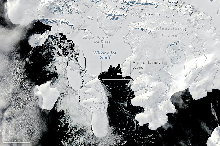
The Wilkins Ice Shelf abuts several large islands west of the Antarctic Peninsula. The shelf’s northern ice front has undergone a series of rapid breakups since the 1990s, and it has been routinely shedding icebergs ever since.
In contrast, the shelf’s southern ice front has been historically stable, according to maps from the U.S Geological Survey. But scientists have noticed recent signs of structural weaknesses here, too, potentially signaling a shift in the shelf’s stability. As a result, scientists have been keeping a close watch on Wilkins and tracking how it is changing. Losses to ice shelves do not contribute directly to sea level rise, but they are important indicators of climate change, and they slow the seaward movement of inland glacial ice.
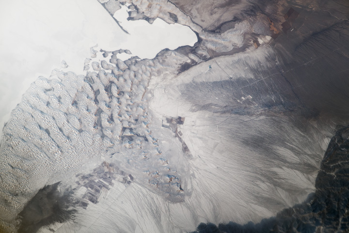
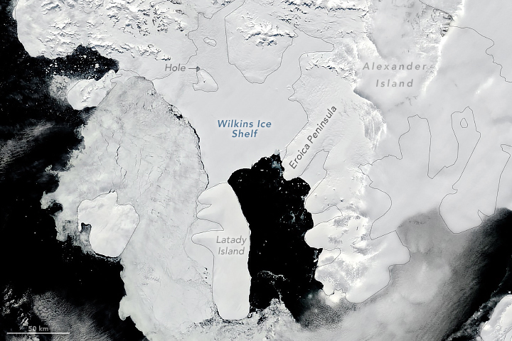
Some of the most recent changes are visible in this image pair, acquired on January 24, 2024 (left), and March 15, 2024 (right), by the MODIS (Moderate Resolution Imaging Spectroradiometer) instrument on NASA’s Terra satellite. The region is exceptionally cloudy, and nearly cloud-free views like these are rare. Notice the small hole in the Wilkins Ice Shelf that exposes the underlying ocean. This oddity has persisted for decades and is thought to be a rare phenomenon.
Also visible is a mixture of sea ice and small icebergs crowding the northern ice front in both images. (Note that the largest pieces in the March 15 image are sea ice, not icebergs). By comparison, the bay near the southern ice front—between Latady Island and Alexander Island’s Eroica Peninsula—stays relatively free of sea ice during the austral melting season. This is typical for the area, and scientists are currently unsure what causes the difference in sea ice abundance on either side of the Wilkins Ice Shelf.
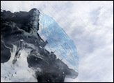
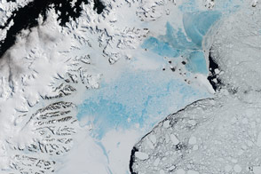
On March 15, another form of ice—an iceberg—drifted away from the southern ice front. Notice the triangular wedge of ice missing from this part of the shelf, which spawned the 7.4-kilometer-long berg drifting in the inlet near Eroica Peninsula. A detailed view of the area on the same day is shown in the image below. The image was acquired with the OLI-2 (Operational Land Imager-2) on Landsat 9.
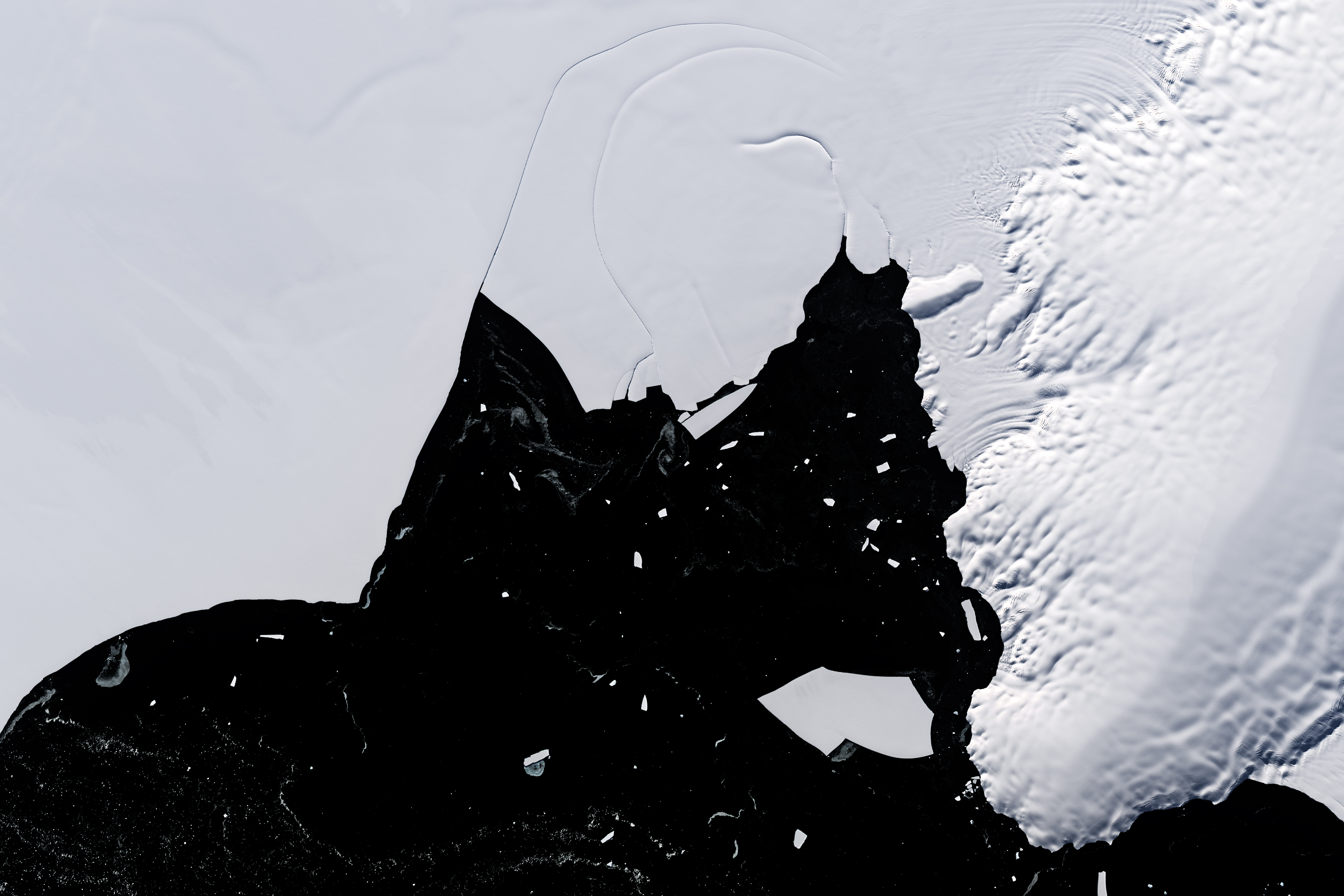
The detailed view shows recent rifts, which curve across the shelf near the new wedge-shaped opening. According to Christopher Shuman, a University of Maryland, Baltimore County, glaciologist based at NASA’s Goddard Space Flight Center, several of these rifts formed in 2022 around the same time that the shelf lost contact with an unnamed ice rise that previously helped stabilize it. “These curving rifts suggest there have been significant impacts on the structural integrity of the shelf ice,” Shuman said.
According to Julie Miller, a research scientist at the University of Colorado, Boulder, retreat along the southern ice front accelerated starting in 2016. Since then, ice losses have amounted to about 150 square kilometers (60 square miles). Miller attributes the retreat to recent record-high surface air temperatures and a sequence of extreme melting events in the Antarctic Peninsula.
All this melting has made the ice shelf a slushy place. Though the water is not visible in natural-color images, airborne radar and ground penetrating surveys, along with cores taken from the firn, have confirmed that much of the shelf contains a meters-thick layer of liquid water known as a “firn aquifer.” This aquifer extends across the entire Wilkins Ice Shelf, including the southern ice front that recently spawned the new iceberg.
“Drainage of mobile liquid water is known to initiate hydrofracture and rapid retreat rifting in ice shelves,” Miller said. “But the relationship between the current retreat of the southern ice front and the firn aquifer is not yet well understood.”
Still, the ice shelf’s rift system, retreat, and loss of contact with stabilizing landforms indicate that the southern ice front may be changing modes, from stable to unstable. “In many respects, it’s amazing that the ice shelf is still here,” Shuman said. “The resistance provided by ice rises and submerged obstructions may no longer be sufficient to keep this ‘great big slushy’ intact for many more years.”
Exactly how long the ice shelf can withstand these signs of instability remains to be seen. In the meantime, Miller said: “We are currently very closely monitoring the stability of the Wilkins Ice Shelf using visible and microwave satellite imagery collected from multiple NASA missions, including MODIS, Landsat, ICESat-2, and SMAP.”
NASA Earth Observatory images by Michala Garrison, using Landsat data from the U.S. Geological Survey, and MODIS data from NASA EOSDIS LANCE and GIBS/Worldview. Story by Kathryn Hansen.