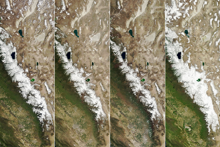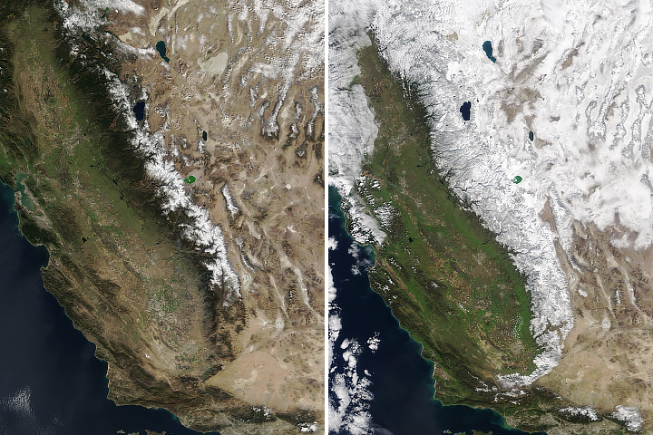
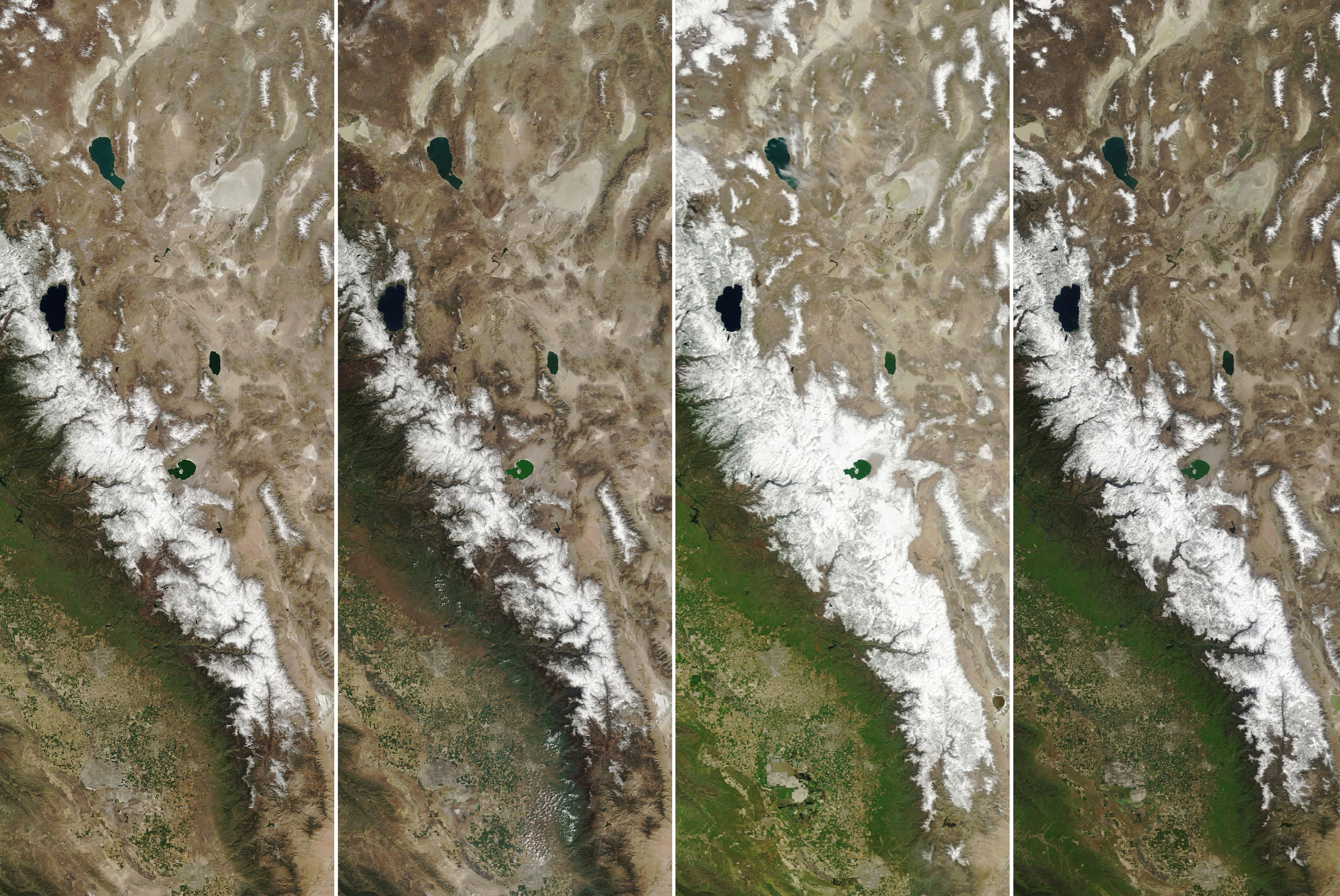
When it comes to mountain snow, the Sierra Nevada is known for its booms and busts: Last year brought record high snow, whereas the snowpack was low in the three years prior. After more than a decade of either unusually wet or unusually dry years, snowpack in the Sierra Nevada was close to normal in 2024.
Snowpack throughout the Sierra range was 110 percent of average on April 1, 2024, according to the California Department of Water Resources (DWR). The department has been making snow water equivalent measurements since the early 1900s, based on 130 ground stations throughout the state.
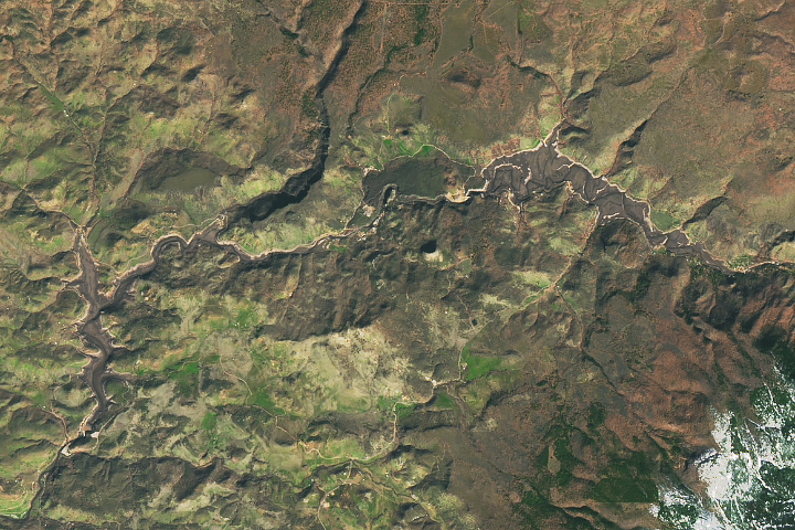
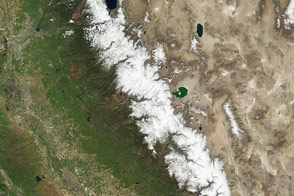
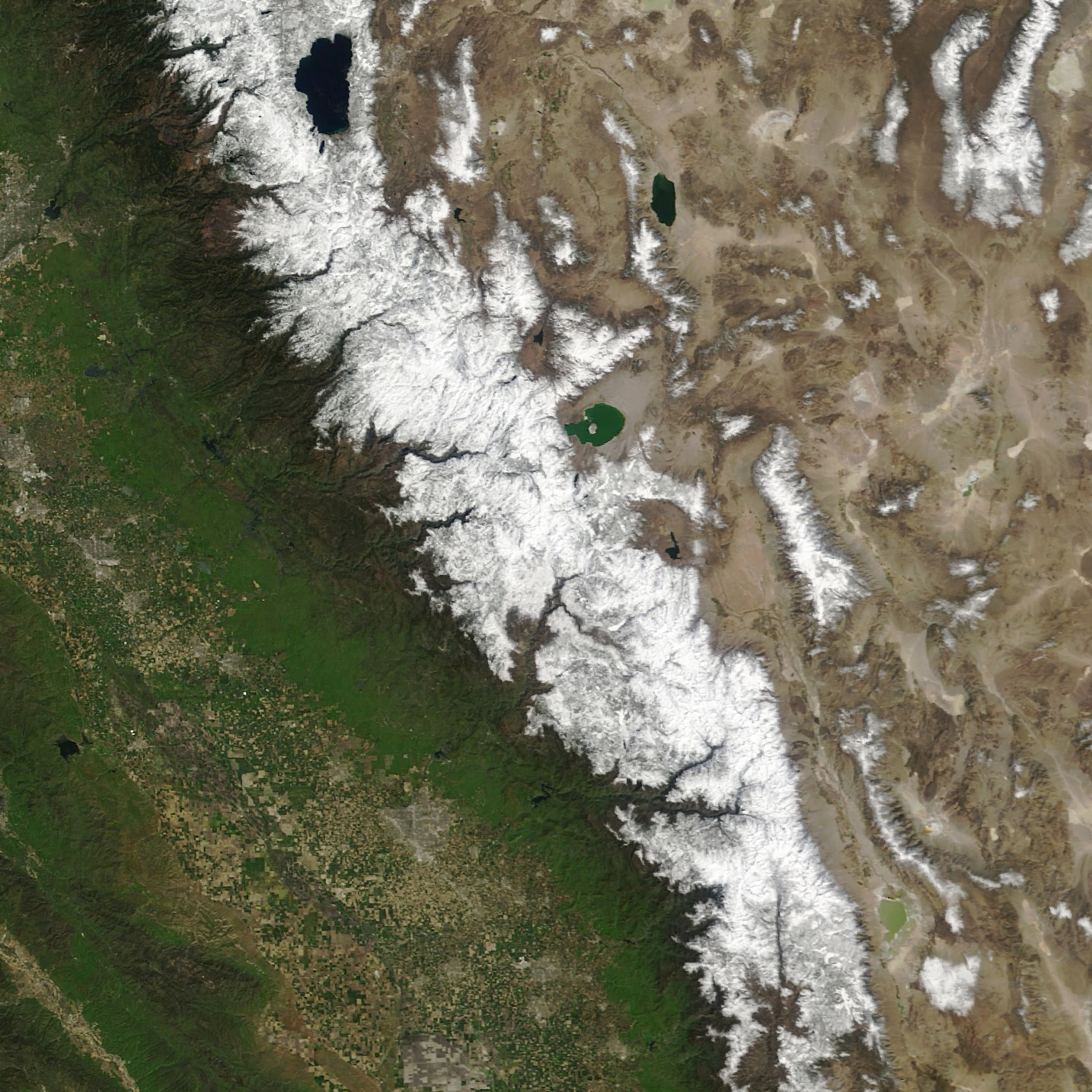
The image above, acquired by the MODIS (Moderate Resolution Imaging Spectroradiometer) on NASA’s Terra satellite, shows snow on the Sierra Nevada on April 2, a day after DWR’s survey. The snowpack on the Sierra Nevada—which supplies about 30 percent of California’s water needs—generally peaks and begins to melt by the beginning of April. Snowpack totals at that time are an important input for spring and summer water supply forecasts.
The last time the snowpack was close to normal on April 1 was 2010, when it was 104 percent. By comparison, it was 232 percent of normal on April 1, 2023. The year before, it was just 35 percent of normal.
“The thing about the Sierras is there’s no such thing as typical,” said Noah Molotch, a hydrologist at the Institute of Arctic and Alpine Research (INSTAAR) and NASA’s Jet Propulsion Laboratory. “This year, now that we’re near 100 percent of average, that’s what’s atypical.”
Following a dry start to the year, late winter storms replenished the now relatively abundant snowpack. Between February 28 and March 3, an atmospheric river and a winter storm delivered widespread precipitation to the western U.S. An estimated 4 to 10 feet (1 to 3 meters) of snow fell in the Northern and Central Sierra Nevada, with the highest totals near Lake Tahoe.
Molotch and colleagues at INSTAAR use remote sensing to assess snow water equivalent in the Sierras and provide DWR with near real-time information about the range’s snow. Their analyses rely on 20 years of data from the MODIS instruments on NASA’s Terra and Aqua satellites. The researchers also use topography data from NASA’s SRTM (Shuttle Radar Topography Mission) and historical weather data from NASA’s Land Information System.
On February 1, 2024, INSTAAR researchers reported that Sierra Nevada snow levels (in snow water equivalent) were between 37 to 53 percent of normal. They crept up to 65 to 78 percent of normal later in the month, but it wasn’t until March, after the storms came through, that snowpack along the range jumped above 100 percent of normal.
Much of the precipitation in the Sierra Nevada comes from atmospheric river events, noted McKenzie Skiles, a snow scientist at the University of Utah. “The series of decent-sized storms toward the end of winter turned what initially looked to be a dry winter into one that was surprisingly average.”
To see changes in the snowpack since 2006, visit our World of Change series.
NASA Earth Observatory images by Wanmei Liang, using MODIS data from NASA EOSDIS LANCE and GIBS/Worldview. Story by Emily Cassidy.